


Table of Contents
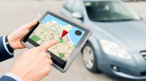
Getting lost is only a matter of option these days. Those who have a smartphone with internet access can find their way wherever they are. Arguably, Google Maps is among the most popular features on Android devices.
Still, there are many other options around, like Apple Maps, MapQuest, OsmAnd, Waze, and so on.
Mapping apps can do more than help tourists find the right streets or drivers find the right turns. Combining geocoding and batching services by http://egon.com can help hauling companies save time and valuable resources, finding the most efficient itineraries across different addresses.
How is Geolocating Technologies Actually Work?
Eyes on the Map
Apps like Google Maps are taken for granted these days, but they are immensely complex. Last February, Google Maps celebrated its 20th anniversary: it was launched as a desktop software on February 8, 2005.
The mobile version would only come two years later for Palm and Blackberry devices (does anyone remember those?), while Android devices included it in 2008.
Nowadays, mapping apps are everywhere, creating a market valued at more than USD 28 billion in 2024, and it’s expected to grow at a CAGR of 11.3% until 2029. Here are some of the most important mapping technologies and how they work.
GPS (Global Positioning System)
GPS technology makes digital mapping possible, and it was already a core feature of the first desktop-based software 20 years ago.
GPS relies on data coming from a constellation of satellites around the globe. Ride-sharing services like Uber have become possible thanks to its ability to pinpoint a person’s location on the map.
Wi-Fi Positioning
In urban areas, GPS signals are often obstructed by tall buildings. That’s when apps use Wi-Fi positioning, tracking users by the Wi-Fi signals sent by their mobile devices. It’s perfect for indoor navigation in large places like airports.
Geofencing
Geofencing technologies have been helping markets and stores prevent shoplifting. It creates a virtual boundary around the premises and tags each product. If the tagged product leaves the premises unauthorized, an alarm is triggered.
The Future Around the Corner
Digital mapping and geolocating services have greatly improved over the past decades but haven’t stopped in time. In fact, today’s cutting-edge technologies might shape the road ahead for this industry.
Augmented Reality

Digital maps are quite interactive already, but they’re about to become even more engaging with Augmented Reality. Location-based entertainment options like Pokemon Go are just the tip of the iceberg. Since AR glasses can overlay digital information onto the users’ location, they are set to revolutionize tourism, real estate, and many other industries.
AI Behind the Wheel
As geolocating technologies get more precise, traffic made from self-driving vehicles is becoming possible. Integrating geospatial data, AI, and machine-learning can instantly create autonomous vehicles capable of reacting to any road condition.
Smart Cities
Increasingly more sophisticated geolocation technologies can pave the way for smart cities. Traffic management, waste disposal, and transportation are real challenges in big cities worldwide. AI-backed geospatial tools can be immensely helpful by anticipating traffic flows and managing public transport, for instance.